![]()
![]()
![]()
Back to
Darby
main page
ACCOMMODATIONS
Bed &
Breakfast
Cabins & Cottages
Campgrounds
Hotels & Motels
Inns & Lodges
RV Parks
Vacation Rentals
More Darby
More Bitterroot Valley
Darby
Hamilton
Stevensville
More Northwest Montana
Bitterroot Valley
Blackfeet Indian Res.
Clark Fork River
Flathead Valley
Kootenai Valley
Missoula Valley
Seeley Swan Valley
Montana Travel Regions and Maps:
Map
North Central
Map
Northeast
Map
Northwest
Map
South Central
Map
Southeast
Map
Southwest
Darby Accommodations
Campgrounds and RV Parks
Bitterroot National Forest. Darby Ranger Station: 712 N. Main, Darby, MT 59829. Phone: 406-821-3913; Fax: 406-821-4264.
- Black Bear Campground: Located on the banks of Skalkaho Creek, this campground offers 6 tent sites with picnic tables and fire rings, RV's up to 50 feet, vault toilet, no water and no garbage service. Nearest town is Hamilton. Elevation: 4,581 feet. GPS: 46.166033; -113.92453.
- Lake Como Campground: One of three campgrounds in the Lake Como Recreation Area and located below Lake Como, this campground offers 1 host site, 10 (125') pull through RV sites with electrical and water hookups, water and garbage service, 3 handicap accessible sites, potable water and vault toilets (4 handicap accessible). Nearest town is Darby. Elevation: 4,231 feet. GPS: 46.068186; -114.235762.
- Rock Creek Horse Camp: Located in the Lake Como Recreation Area, this campground has 11 tent and small trailer sites, handicap accessible vault toilets, gravel surfaced roads, garbage service, stock facilities (hitch rails, stock ramp and feed bunks), a few trails leaving from the horse camp. The trailhead is equipped with an accessible horse mounting platform. No water. Nearest town is Darby. Elevation: 4,224 feet. GPS: 46.063737; -114.231098.
- Schumaker Campground: Located on the edge of Twin Lakes near the Selway Bitterroot Wilderness, this campground has 1 host site, 16 campsites, RV's up to 55 feet, 2 vault toilets, 2 handicap accessible sites and no water. Nearest town is Darby. Elevation: 6,575 feet. GPS: 46.150553; -114.496332.
- Three Frogs Campground: This newly constructed campground has 16 small trailer campsites up to 30 feet, 4 walk-in tent sites, vault toilets, picnic tables, fire rings, water, garbage service and gravel surfaced roads. Some campsites are also equipped with tent pads. Nearest town is Darby. Elevation: 4,292 feet. GPS: 46.066415; -114.248935.
- Three Sisters Group Site Campground: This newly constructed campground can accommodate 75 people and offers a 0' x 30' pavillion, 8 picnic tables, group size BBQ grill, group size fire ring with handcrafted wooden benches around it, 2 vault toilets and parking for 25 vehicles. There is no water or electricity. Nearest town is Darby. Elevation: 4,215 feet. GPS: 46.064330; -114.232124.
Painted Rocks State Park. 8809 West Fork Road, Darby, MT
59829. Phone: 406-273-4253. GPS: 45.68128; -114.30100.
Camping at Painted Rocks features 25 sites with a 25 feet limit on RV's, boat ramp, dock and vault toilets.
Travellers Rest Cabins and RV Park. 601 N. Main Street, Darby, MT 59829. Phone: 406-821-3282; Fax: 406-821-2225. E-mail
West Fork Lodge. 5857 West Fork Road, Darby, MT 59829. Phone: 406-821-1853. E-mail
Go Northwest!
Bookstore
Best selection of books on the Northwest.
Click
here!
 Moon
Spotlight Glacier National Park Camping by Becky Lomax. This compact
guide covers the region's best campsites. Each camp listing has at-a-glance
icons that indicate nearby trails, activities, hot springs and which campsites and
trails allow dogs. Also included are easy-to-follow maps and clear driving directions.
Order now...
Moon
Spotlight Glacier National Park Camping by Becky Lomax. This compact
guide covers the region's best campsites. Each camp listing has at-a-glance
icons that indicate nearby trails, activities, hot springs and which campsites and
trails allow dogs. Also included are easy-to-follow maps and clear driving directions.
Order now...
 Frommer's
Montana and Wyoming, 8th Edition by Eric Peterson. All the highlights,
from Yellowstone, Glacier, and Grand Teton National Parks to small old-west
towns. Also get in-depth advice on planning an active vacation to the area,
recommendations on planning a successful family vacation; and how to make
the most of your time in the West.
Order now...
Frommer's
Montana and Wyoming, 8th Edition by Eric Peterson. All the highlights,
from Yellowstone, Glacier, and Grand Teton National Parks to small old-west
towns. Also get in-depth advice on planning an active vacation to the area,
recommendations on planning a successful family vacation; and how to make
the most of your time in the West.
Order now...
 Montana
Adventure Guide by Genevieve Rowles. Offering coverage of the history,
culture, geography and climate, this book also looks at wilderness trips in
Montana, USA. Areas featured include Flathead and Clearwater Mountains, and
fly-fishing, Nordic skiing, rock-hounding and overnight hiking excursions
are all covered.
Order now...
Montana
Adventure Guide by Genevieve Rowles. Offering coverage of the history,
culture, geography and climate, this book also looks at wilderness trips in
Montana, USA. Areas featured include Flathead and Clearwater Mountains, and
fly-fishing, Nordic skiing, rock-hounding and overnight hiking excursions
are all covered.
Order now...
 Montana
Off the Beaten Path, 9th Edition: A Guide to Unique Places by Ednor
Therriault and Michael McCoy. Discover hidden attractions, unusual
locales, unique finds and quirky cultural tidbits; all the interesting
stuff you'd want to see and experience if you only knew about them.
Order now...
Montana
Off the Beaten Path, 9th Edition: A Guide to Unique Places by Ednor
Therriault and Michael McCoy. Discover hidden attractions, unusual
locales, unique finds and quirky cultural tidbits; all the interesting
stuff you'd want to see and experience if you only knew about them.
Order now...
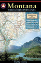 Benchmark
Montana Road & Recreation Atlas by Benchmark Maps. Large-scale Landscape
MapsTM and a complete 30-page Recreation Guide make it the ideal planning
tool for any outdoor adventure. Benchmark field-checkers drove thousands of
miles to make sure the Montana Road & Recreation Atlas is the most accurate
and reliable map product.
Order now...
Benchmark
Montana Road & Recreation Atlas by Benchmark Maps. Large-scale Landscape
MapsTM and a complete 30-page Recreation Guide make it the ideal planning
tool for any outdoor adventure. Benchmark field-checkers drove thousands of
miles to make sure the Montana Road & Recreation Atlas is the most accurate
and reliable map product.
Order now...
We appreciate your orders. They help keep
Go Northwest! online.
Northwest Books
from . . .
![]()
Shopping at
Go Northwest!
![]()
![]()
![]()
![]()