![]()
![]()
![]()
![]()
Back to
Map Store
main page

Click image above to see a
map of Washington
Click image above to see a
map of
Washington wineries

Click image above to see a
map of
Washington
ski areas
More Washington Maps
Hood Canal
Mt.
Rainier Area
Mt.
St. Helens Area
Olympic National Park
WA Ski Areas
Maps of...
North America
Pacific Northwest
British Columbia
Idaho
Montana
Oregon
Washington
More Shopping
Bookstore
Electronic Travel Gear
Map Store
Travel Store
To Visit Made in the
Northwest Stores, Click on one of the following:
British Columbia
Idaho
Montana
Oregon
Washington
More Pacific Northwest
British
Columbia
Idaho
Montana
Oregon
Washington
Wyoming
The Pacific Northwest
Maps of Washington
About the Map Store
We offer most maps via the
Associate Program of Amazon.com. In essence, they pay us a percentage
of the sale. There is no increased cost to you.
Go Northwest! is a free web site that you are welcome to use without obligation. If you would like to support Go Northwest!, simply begin every new shopping trip to Amazon.com by clicking on any book link or Amazon.com logo on our site.
How to buy
Click a map title here. At the Amazon.com site, buying the map is basically a two-step process.
- Click "add to shopping cart". This step is not an obligation to buy.
- Click "proceed to checkout". Just follow their instructions.
- To buy more than one map mentioned here, use your browser's "back" button to return to this map store, and click on the map's title.
With thanks
We hope you find the right map for your explorations of the Northwest! We
would love to hear about your map recommendations, by
email.
Here you will find gathered in one place, the hardcopy maps and atlases we have highlighted on various pages at Go Northwest! You can order these maps online using credit card, check or postal money order. Just click on a title.
Each map comes with detailed road designation, extensive labeling of physical features such as mountain ranges, valleys and peaks, and insets of major city, national park, or area of historical significance.
Washington State
Washington Atlas and Gazetteer
by DeLorme Mapping Company
January 2000, Paperback, 10th edition, 104 pages, (roadmaps)
Topographic maps of the entire state, with back roads and outdoor
recreation.
Washington Road & Recreation Atlas
by Benchmark Maps
January 2013, Paperback, 6th edition, 128 pages, (roadmaps)
Includes Landscape Maps, Recreation Guide with public lands information, and
a special Seattle/Tacoma Recreation Guide.
Washington State Map
by Rand McNally
April 2010, 1 page folded map 4.5 x 10 inches.
Rand McNally Easyfinder Washington folded map
by Rand McNally
July 2013, heavy duty lamination.
Washington State Guide Map
by National Geographic
January 2013, 2 pages.
Waterproof, tear resistant travel map 4.2 x 8.7 inches.
Mount Rainier
Mt. Rainier National Park - Centennial Edition
by Stanley L Friedman
June 2000, Printed on 40x56 waterproof material and folded to 5x8 for easy
storage.
Mt. Rainier National Park, Map and Trail Guide
by Mark Wigg (Author) and GeoDataScape Inc. (Illustrator)
January 2010, Size: 4"x9" folded, 24"x36" flat.
Mount Rainier National Park (National Geographic: Trails Illustrated
Map #217)
January 2009, Waterproof, tear resistant topographic map with UTM grids.
Seattle
Easyfinder Seattle Map
by Rand McNally
May 2004, 1 page
A laminated map which is easy to handle and durable. Coverage of downtown
and most major tourist and business districts, with a complete street index.
Let's Go Map Guide Seattle
by Let's Go Publications
March 2001, Paperback, 32 pages.
The Seattle Greater Street Atlas
by Kappa Map Group
June 2013, Paperback, 204 pages.
Fully colored atlas covering West - King, Pierce & Snohomish Counties.
Seattle Map (Seattle Downtown Plus Road, Recreation & Transit Map)
by Great Pacific Recreation & Travel Maps
May 2013, 12th edition, 2 pages.
Detailed walking-scale coverage of Downtown plus adjacent neighborhoods.
Streetwise Seattle Map
by Streetwise Maps
June 2013, 3.7 x 8.4 inches
Pocket sized folding, laminated city center street map.
To order,
click on map title.
Go Northwest!
Bookstore
Best selection of books on the Northwest.
Click
here!
 Benchmark
Washington Road & Recreation Atlas- 6th Edition by Benchmark Map.
Field-checked Landscape Maps(tm) show complete road detail. The revised
recreation guide is organized by categories such as attractions and activities.
The metro map section covers the greater Seattle-Tacoma area.
Order now...
Benchmark
Washington Road & Recreation Atlas- 6th Edition by Benchmark Map.
Field-checked Landscape Maps(tm) show complete road detail. The revised
recreation guide is organized by categories such as attractions and activities.
The metro map section covers the greater Seattle-Tacoma area.
Order now...
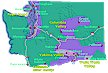
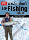 Washington's
Top Fishing Maps by Cascade View Publishing. This book has all the
fishing information needed to know including where to fish for certain
species, details about streams, lakes and saltwater and of course, maps.
Order now...
Washington's
Top Fishing Maps by Cascade View Publishing. This book has all the
fishing information needed to know including where to fish for certain
species, details about streams, lakes and saltwater and of course, maps.
Order now...
 Great
Places: Washington: A Recreational Guide to Washington's Public Lands and
Historic Places for Birding, Hiking, Photography, Fishing, Hunting and
Camping
by John Kruse. The geology, animal and plant life, and history of
Washington's most-storied and scenic locales, including the best local
lodging and amenities are explained in this full color guide.
Order now...
Great
Places: Washington: A Recreational Guide to Washington's Public Lands and
Historic Places for Birding, Hiking, Photography, Fishing, Hunting and
Camping
by John Kruse. The geology, animal and plant life, and history of
Washington's most-storied and scenic locales, including the best local
lodging and amenities are explained in this full color guide.
Order now...
 Washington
River Maps & Fishing Guide
by Doug Rose. Detailed maps covering over 1200 miles of river. Included for
each river are the best seasons, species, available illustrated fishing
methods, best flies and best gear for individual rivers and species, fly
hatches, knots, launches, parks, number of hookups per year, size of runs,
parks, services, guides.
Order now...
Washington
River Maps & Fishing Guide
by Doug Rose. Detailed maps covering over 1200 miles of river. Included for
each river are the best seasons, species, available illustrated fishing
methods, best flies and best gear for individual rivers and species, fly
hatches, knots, launches, parks, number of hookups per year, size of runs,
parks, services, guides.
Order now...
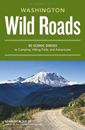 Wild
Roads Washington: 80 Scenic Drives to Camping, Hiking Trails, and Adventures
by Seabury Blair Jr. This adventure guidebook details the forest roads of
Washington with information on hikes off each route as well as driving
routes that provide scenic vistas almost as good as those reached by foot.
Order now...
Wild
Roads Washington: 80 Scenic Drives to Camping, Hiking Trails, and Adventures
by Seabury Blair Jr. This adventure guidebook details the forest roads of
Washington with information on hikes off each route as well as driving
routes that provide scenic vistas almost as good as those reached by foot.
Order now...
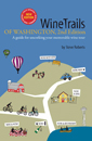 WineTrails
of Washington, 2nd Edition by Steve Roberts, Sunny Parsons and Lisa Pettit
(Illustrator). This guide details 32 different Winetrails. Find contact information,
photos and descriptions for each winery. Learn all about tasting rooms and even
wine etiquette on your wine tour.
Order now...
WineTrails
of Washington, 2nd Edition by Steve Roberts, Sunny Parsons and Lisa Pettit
(Illustrator). This guide details 32 different Winetrails. Find contact information,
photos and descriptions for each winery. Learn all about tasting rooms and even
wine etiquette on your wine tour.
Order now...
We appreciate your orders. They help keep
Go Northwest! online.
Northwest Books
from . . .
![]()
Shopping at
Go Northwest!
![]()
![]()
![]()
![]()