![]()
![]()
![]()
![]()
Back to
Hungry Horse
main page
VISITOR INFORMATION
Location
Getting There
Description
Community Web Sites
Newspapers
Ranger Stations
More Hungry Horse
Nearby Cities and Towns
Bigfork, 29 miles
Coram, 3 miles
Columbia Falls, 7 miles
Kalispell, 22 miles
Lakeside, 39miles
Polebridge, 37 miles
Somers, 33 miles
Whitefish, 16 miles
More cities and towns in Northwest Montana
More Northwest Montana
Bitterroot
Valley
Blackfeet Indian Res.
Clark Fork River
Flathead Valley
Kootenai Valley
Missoula Valley
Seeley Swan Valley
Montana Travel Regions and Maps:
Map
North Central
Map
Northeast
Map
Northwest
Map
South Central
Map
Southeast
Map
Southwest
Hungry Horse, Montana
Visitor Information
Location
Hungry Horse lies between Columbia Falls to the west and West Glacier to the east on US Highway 2.
Getting to Hungry Horse
Road
 The
main route to Hungry Horse is US Highway 2. Closest Interstate is I-90,
which is about 140 miles south of Hungry Horse.
The
main route to Hungry Horse is US Highway 2. Closest Interstate is I-90,
which is about 140 miles south of Hungry Horse.
Air
Glacier Park International Airport at
Kalispell. Services include Big Sky Airlines, Delta Airlines, Horizon
Airlines, Northwest Airlines and Holman Aviation (private charters).
Rail
The daily Amtrak passenger service the
Empire Builder runs between Seattle/Portland and Chicago. Nearby depots
are in: Whitefish (35 miles west,
toll free phone: 1-800-862-7245) and
West Glacier.
Description
Like nearby Coram and Martin City, this is a community which sprang up with the construction of Hungry Horse Dam during the 1940s and 50s. Montana's tallest dam (564 feet) sits wedged in a narrow canyon four miles east of the town of Hungry Horse. The dam blocks the South Fork of the Flathead River to make the 34-mile long Hungry Horse Reservoir. Free tours of the dam are available.
Community Web Sites
Newspapers
Hungry Horse News. 926 Nucleus Avenue, PO Box 189, Columbia Falls, MT 59912. Phone: 406-892-2151; Fax:406-892-5600. E-mail
Ranger Stations
Flathead National Forest - Glacier View/Hungry Horse Ranger District. 10 Hungry Horse Drive, Hungry Horse, MT 59919. Phone: 406-387-3800; Fax: 406-387-3889.
Go Northwest!
Bookstore
Best selection of books on the Northwest.
Click
here!
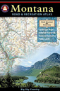 Benchmark
Montana Road & Recreation Atlas by Benchmark Maps. Large-scale Landscape
MapsTM and a complete 30-page Recreation Guide make it the ideal planning
tool for any outdoor adventure. Benchmark field-checkers drove thousands of
miles to make sure the Montana Road & Recreation Atlas is the most accurate
and reliable map product.
Order now...
Benchmark
Montana Road & Recreation Atlas by Benchmark Maps. Large-scale Landscape
MapsTM and a complete 30-page Recreation Guide make it the ideal planning
tool for any outdoor adventure. Benchmark field-checkers drove thousands of
miles to make sure the Montana Road & Recreation Atlas is the most accurate
and reliable map product.
Order now...
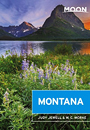 Moon Montana,
9th Edition (Moon Handbooks) by Judy Jewell and W.C. McRae. This guide
has complete information about all of Big Sky Country, from Yellowstone
National Park to the eastern prairies of the state, to help the traveler
plan a memorable vacation.
Order now...
Moon Montana,
9th Edition (Moon Handbooks) by Judy Jewell and W.C. McRae. This guide
has complete information about all of Big Sky Country, from Yellowstone
National Park to the eastern prairies of the state, to help the traveler
plan a memorable vacation.
Order now...
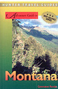 Montana
Adventure Guide by Genevieve Rowles. Offering coverage of the history,
culture, geography and climate, this book also looks at wilderness trips in
Montana, USA. Areas featured include Flathead and Clearwater Mountains, and
fly-fishing, Nordic skiing, rock-hounding and overnight hiking excursions
are all covered.
Order now...
Montana
Adventure Guide by Genevieve Rowles. Offering coverage of the history,
culture, geography and climate, this book also looks at wilderness trips in
Montana, USA. Areas featured include Flathead and Clearwater Mountains, and
fly-fishing, Nordic skiing, rock-hounding and overnight hiking excursions
are all covered.
Order now...
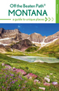 Montana
Off the Beaten Path, 9th Edition: A Guide to Unique Places by Ednor
Therriault and Michael McCoy. Discover the hidden attractions, unusual
locales, unique finds and quirky cultural tidbits; all the interesting
stuff you'd want to see and experience if you only knew about them.
Order now...
Montana
Off the Beaten Path, 9th Edition: A Guide to Unique Places by Ednor
Therriault and Michael McCoy. Discover the hidden attractions, unusual
locales, unique finds and quirky cultural tidbits; all the interesting
stuff you'd want to see and experience if you only knew about them.
Order now...
 Hidden Montana: Including Missoula, Helena, Bozeman, and Glacier and
Yellowstone National Parks by John Gottberg. This guide contains
detailed maps, web sites for listings, author picks plus walking and
driving tours to explore Montana. Over 70 parks, towns, ski villages and
wilderness areas are detailed in this book.
Order now...
Hidden Montana: Including Missoula, Helena, Bozeman, and Glacier and
Yellowstone National Parks by John Gottberg. This guide contains
detailed maps, web sites for listings, author picks plus walking and
driving tours to explore Montana. Over 70 parks, towns, ski villages and
wilderness areas are detailed in this book.
Order now...
We appreciate your orders. They help keep
Go Northwest! online.
Northwest Books
from . . .
![]()
Shopping at
Go Northwest!
![]()
![]()
![]()
![]()