![]()
![]()
![]()
![]()
Where to stay and
what to do in
Riggins
Nearby Cities and Towns
Cottonwood, 60 miles
Grangeville, 45 miles
Lucile, 9 miles
Pollock, 8 miles
White Bird, 30 miles
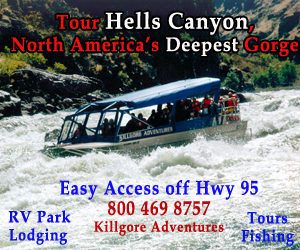
Hells Canyon National Recreation Area
Idaho Travel Regions and Maps
Map
Central
Map
Eastern
Map
North Idaho
Map
North Central
Map
South Central
Map
Southeast
Map
Southwest
North Central Travel Region
Riggins, Idaho

Deep within a canyon is Riggins, a small community located at the confluence of the Salmon and Little Salmon Rivers. These rivers provide ample opportunity for excellent whitewater rafting, jet boating, kayaking, Salmon and steelhead fishing.
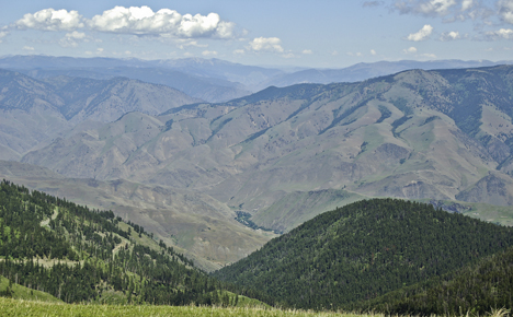
Hiking and mountain biking excursions can be found just a few miles southwest is Hells Canyon National Recreation Area and Seven Devils Mountains or turn east and where you'll find Frank Church Wilderness Area and Gospel Hump.
Find all the visitor information you need to plan your trip to Riggins. Just use the navigation links in the left hand column or the drop down menu at the top of the page to find where to stay, where to eat, what to see and what to do.

|
Weather
|
Click on the town and road map above to locate cities, towns, attractions and points of interest. |


Go Northwest!
Bookstore
Best selection of books on the Northwest.
Click
here!
 Idaho
Off the Beaten Path: A Guide to Unique Places, 9th Edition by Julie Fanselow.
This guidebook features fun, unusual and different things travelers want to see and experience.
Discover the best in local dining, quirky cultural tidbits, hidden
attractions and unique finds in the Gem State.
Order now...
Idaho
Off the Beaten Path: A Guide to Unique Places, 9th Edition by Julie Fanselow.
This guidebook features fun, unusual and different things travelers want to see and experience.
Discover the best in local dining, quirky cultural tidbits, hidden
attractions and unique finds in the Gem State.
Order now...
 Compass
American Guides: Idaho, 3rd Edition by John Gottberg. Spectacular photography, evocative prose, insider tips, and detailed
color maps to help you make the most of your trip. Written by longtime Idaho
residents, this book provides in-depth coverage of the history, culture and
character of one of America's most spectacular destinations!
Order now...
Compass
American Guides: Idaho, 3rd Edition by John Gottberg. Spectacular photography, evocative prose, insider tips, and detailed
color maps to help you make the most of your trip. Written by longtime Idaho
residents, this book provides in-depth coverage of the history, culture and
character of one of America's most spectacular destinations!
Order now...
We appreciate your orders. They help keep
Go Northwest! online.
Northwest Books
from . . .
![]()
Shopping at
Go Northwest!
![]()
![]()
![]()
![]()