Back to
Washington
main page
The town and road map of Washington's Cascades will help you locate cities, towns, attractions and points of interest.
Explore the Cascades
Cascade Loop Birding Trail
Cascade Loop Scenic Drive
Cascade Visitor Information
Cities and Towns of the Washington Cascades
Travel Articles
Hike to Blanca Lake
Hike to Hidden Lake Peaks
Hike to Lake Talapus
Hike up Mount Si
Rattlesnake Ridge Hike
Nisqually Valley
Click
here for Video
More
Cascades
North Cascades
Central Cascades
South Cascades
Mountain Passes
Blewett Pass
Snoqualmie Pass
-Hiking
-Skiing
-Scenic Drives
Stevens Pass
-View Cam
White Pass
National Parks
Mount Rainier
Mount. St. Helens
North Cascades
National Forests
Gifford Pinchot
Mt. Baker-Snoqualmie
Okanogan-Wenatchee
National Wilderness Areas
Alpine Lakes
Boulder River
Clearwater
Glacier Peak
Glacier View
Goat Rocks
Henry M Jackson
Indian Heaven
Lake Chelan-Sawtooth
Mt Adams
Mt Baker
Noisy-Diobsud
Norse Peak
Pasayten
Tatoosh
Trapper Creek
William Douglas
Scenic Drives
Cascade Loop
Mt Baker Highway
North Cascades Hwy
Snoqualmie Pass
Stephen Mather Memorial Parkway
Stevens Pass
Scenic Sights
Snoqualmie Falls
Ski Areas
Crystal Mountain
Echo Valley
Loup Loup
Methow Valley
Mission Ridge
Mt. Baker
Mt Tahoma
Powder Cats
Sitzmark Lifts
Stevens Pass
Summit at Snoqualmie
Sun Mountain
White Pass
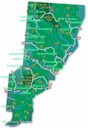
Washington Travel Regions and Maps
Map
Cascade Mountains
Map
Northeast
Map
Northwest
Map
Olympic Peninsula
Map
Puget Sound
Map
San Juan Islands
Map
South Central
Map
Southeast
Map
Southwest
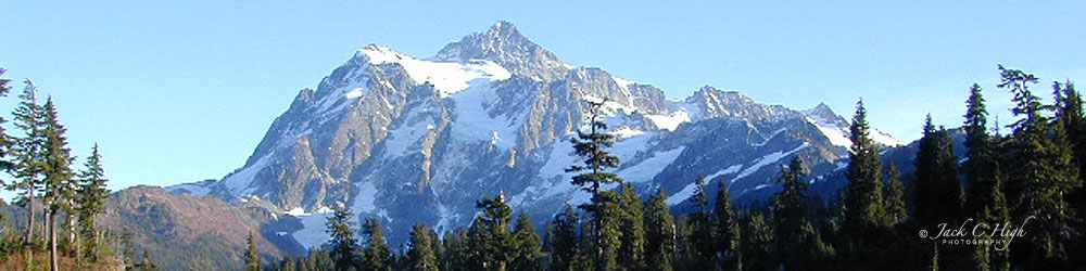
Washington Cascades Offer Outstanding Recreational Year-Round Activities
The Washington Cascades, part of the Cascade Mountain Range which extends from British Columbia to California, offer hundreds of miles of hiking, snow-shoeing, skiing and cross-country skiing trails; many ski resorts; and countless opportunities for camping, backpacking and mountain climbing in one of the world's most beautiful and accessible mountain ranges.
In Washington, this lengthy range of forested mountains is roughly divided into three different regions, each offering its own unique and outstanding natural features. The three regions are briefly described below. For more detail, follow the links:
North Cascades
The North Cascades defining features are Mount Baker, the North Cascades National Park, several National Wilderness Areas, the Ross Lake National Recreation Area and the Chelan Lake National Recreation Area.
Cities in the North Cascades
Buckley,
Chelan, Concrete, Conconully,
Darrington, Diablo, Fortson, Glacier,
Granite Falls, Hazel, Marblemount, Manson, Maple Falls,
Mazama, Methow, Mount Baker,
Newhalem, Pateros, Robe, Rockport, Stehekin,
Twisp, Van Horn, Winthrop.
Central Cascades
The Central Cascades offer an extensive array of outdoor recreational activities less than two hours by car from Seattle, making the area a popular playground for hiking, backpacking, climbing and skiing for one of the Pacific Northwest's largest metropolitan centers.
Cities in the Central Cascades
Baring, Carnation, Cashmere, Cle Elum, Coles Corner, Easton, Fall City, Gold Bar,
Index, Leavenworth, Monroe,
North Bend, Peshastin, Plain, Roslyn,
Skykomish, Snoqualmie, Snoqualmie Pass,
Sultan, Thorp, Wenatchee
South Cascades
The South Cascades' three snow-capped volcanoes, Mount Adams, Mount Rainier and Mount St. Helens, rise dramatically above their lesser neighbors as the outstanding featured attractions in this widely popular recreational area of south central Washington.
Cities in the South Cascades
American River, Alder, Ashford, Carson,
Cougar, Eatonville,
Elbe, Enumclaw, Glenoma,
Greenwater, Mineral,
Morton, Mossyrock, Nile, Packwood,
Randle, Rimrock, Stevenson,
Trout Lake
Explore the Cascades
Cascade Loop Scenic Drive
Washington's Cascade Loop is a memorizing drive extending approximately 440 miles. Beginning in Everett, about 30 miles north of Seattle, you will travel from the Puget Sound to the Cascade Mountains in Northwest Washington. Along the way, you can explore North Cascades National Park, national forests, the spectacular Columbia River Valley, historic seaside towns, the Bavarian town Leavenworth, old-time western town Winthrop and many other wonderful towns. Find more information on the official Cascade Loop website including map of byway, interactive map for trip planning, videos, destinations, points of interest, places to stay, outdoor recreational activities and much more.
Find road and pass conditions, traffic cams, weather and other byways in the Cascade Loop from Washington State Determent of Transportation (WSDOT). Please note North Cascades Highway is closed during winter months.
Cascade Loop Birding Trail
The Great Washington State Birding Trail Cascade Loop by Audubon Washington's website features a map of the birding trail and where to spot specific types of birds along the way. There are links to purchasing your map and apps for your phones. Learn how to conserve natural ecosystems and more.
Go Northwest!
Bookstore
Best selection of books on the Northwest.
Click here!
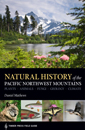 Natural
History of the Pacific Northwest Mountains: Timber Press Field Guide (A Timber Press Field Guide) by Daniel Matthews. This book
provides an overview of the Cascade region. Learn about the history, landscape, geology, weather, flora and fauna of the
Cascade region. Color photographs are also included.
Order now...
Natural
History of the Pacific Northwest Mountains: Timber Press Field Guide (A Timber Press Field Guide) by Daniel Matthews. This book
provides an overview of the Cascade region. Learn about the history, landscape, geology, weather, flora and fauna of the
Cascade region. Color photographs are also included.
Order now...
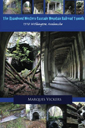 The
Abandoned Western Cascade Mountain Railroad Tunnels: 1910 Wellington Avalanche by Marques Vickers. Learn about the
Wellington avalanche that killed almost 100 people through photographs and descriptions. Hiking the Iron Goat Trail
retraces the former route of Great Northern Railway.
Order now...
The
Abandoned Western Cascade Mountain Railroad Tunnels: 1910 Wellington Avalanche by Marques Vickers. Learn about the
Wellington avalanche that killed almost 100 people through photographs and descriptions. Hiking the Iron Goat Trail
retraces the former route of Great Northern Railway.
Order now...
 Cascades
Rock - 160 Best Multipitch Climbs of All Grades by Blake Herrington. This book is full of information including details
on routes, topos and stories of local climbers covering mountain and alpine routes in the Cascade Mountains of Washington and BC
plus rock climbing in nearby towns.
Order now...
Cascades
Rock - 160 Best Multipitch Climbs of All Grades by Blake Herrington. This book is full of information including details
on routes, topos and stories of local climbers covering mountain and alpine routes in the Cascade Mountains of Washington and BC
plus rock climbing in nearby towns.
Order now...
 Selected
Climbs in the Cascades Volume I by Jim Nelson and Peter Potterfield. A
collection of over 75 popular climbing routes are featured along with
photographs (half with route overlays), maps and detailed descriptions for a
variety of climbs such as ice climbs, hard rock and alpine routes.
Order now...
Selected
Climbs in the Cascades Volume I by Jim Nelson and Peter Potterfield. A
collection of over 75 popular climbing routes are featured along with
photographs (half with route overlays), maps and detailed descriptions for a
variety of climbs such as ice climbs, hard rock and alpine routes.
Order now...
 Selected
Climbs in the Cascades Volume II by Jim Nelson and Peter Potterfield.
Features 100 routes, including top favorite sport and crag climbing areas.
Illustrated throughout with black and white photographs, several with route
overlays. Highlights fun, quality climbs for all skill levels.
Order now...
Selected
Climbs in the Cascades Volume II by Jim Nelson and Peter Potterfield.
Features 100 routes, including top favorite sport and crag climbing areas.
Illustrated throughout with black and white photographs, several with route
overlays. Highlights fun, quality climbs for all skill levels.
Order now...
 Moon
Washington, 11th Edition (Moon Handbooks) by Matthew Lombardi. This
travel writer and Seattle resident gives an insider's view of everything
the Evergreen State has to offer such as great places to eat, scenic
drives and volunteer vacations. Discover Seattle's arts and culture,
details on climbing Mt Rainier and so much more.
Order now...
Moon
Washington, 11th Edition (Moon Handbooks) by Matthew Lombardi. This
travel writer and Seattle resident gives an insider's view of everything
the Evergreen State has to offer such as great places to eat, scenic
drives and volunteer vacations. Discover Seattle's arts and culture,
details on climbing Mt Rainier and so much more.
Order now...
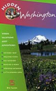 Hidden Washington: Including Seattle, Puget Sound, San Juan Islands,
Olympic Peninsula, Cascades and Columbia River Gorge (Hidden Travel) by
Eric Lucas. This author gets to know each community by going from
neighborhood to neighborhood. This book will take you to all the great
spots while describing both the famous attractions and hidden favorites.
Order now...
Hidden Washington: Including Seattle, Puget Sound, San Juan Islands,
Olympic Peninsula, Cascades and Columbia River Gorge (Hidden Travel) by
Eric Lucas. This author gets to know each community by going from
neighborhood to neighborhood. This book will take you to all the great
spots while describing both the famous attractions and hidden favorites.
Order now...
We appreciate your orders. They help keep
Go Northwest! online.
Northwest Books
from . . .
![]()
Shopping at
Go Northwest!
![]()
![]()
![]()
![]()