![]()
![]()
![]()
![]()
Back to
Willamette Valley
main page
Cities and Towns of Willamette Valley
Albany
Amity
Brownsville
Corvallis
Cottage Grove
Dallas
Dundee
Eugene
McMinnville
Newberg
Salem
Silverton
Springfield
Woodburn
More Oregon
ACTIVITIES
Snow Skiing
Tours
Tour Operators
Whitewater Rafting
ATTRACTIONS
Lighthouses
--Haceta Head
FOOD AND BEVERAGE
Wine Country
VISITOR INFORMATION
Cities and Towns
Map of Oregon
Oregon Travel Regions and Maps:
Map
Cascade Mountains
Map
Central
Map
Coast
Map
Columbia River
Map
Northeast
Map
Portland Area
Map
Southern
Map
Willamette Valley
Willamette Valley Oregon
Map
This map of the Willamette Valley in Oregon shows the major interstates and state highways, cities and towns. Find scenic wilderness areas in Siuslaw National Forest. Salem, the state capitol, is marked in yellow for easy identification. Click on any to city or town to find more information on accommodations and lodging, activities and outdoor recreation, attractions, food and beverage, visitor information and shopping venues. Utilize the left column to find more information on Willamette Valley and more Oregon maps.

Go Northwest!
Bookstore
Best selection of books on the Northwest.
Click here!
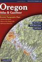 Oregon
Atlas & Gazetteer by Delorme. Beautiful, detailed, large-format maps of
every state. Perfect for home and office reference, and a must for all your
vehicles. Gazetteer information may include: campgrounds, attractions, historic
sites & museums, recreation areas, trails, freshwater fishing site & boat
launches, canoe trips or scenic drives.
Order now...
Oregon
Atlas & Gazetteer by Delorme. Beautiful, detailed, large-format maps of
every state. Perfect for home and office reference, and a must for all your
vehicles. Gazetteer information may include: campgrounds, attractions, historic
sites & museums, recreation areas, trails, freshwater fishing site & boat
launches, canoe trips or scenic drives.
Order now...
 Oregon
Lake Maps & Fishing Guide by Gary Lewis. Information source for 39
lakes and their surrounding communities. Find roads, access points, tackle
guide, types of bait to use, fishing methods, where to go bank fishing,
accommodations and related services plus much more.
Order now...
Oregon
Lake Maps & Fishing Guide by Gary Lewis. Information source for 39
lakes and their surrounding communities. Find roads, access points, tackle
guide, types of bait to use, fishing methods, where to go bank fishing,
accommodations and related services plus much more.
Order now...
 Backroads
& Byways of Oregon: Drives, Day Trips & Weekend Excursions by Crystal
Wood. With natives as your guides, this series leads you down the road less
traveled. Offering up 11 distinctive road trips and weekend getaways-from
the awe-inspiring Oregon Coast to the geological wonders of Mt. Hood-this
one-of-a-kind guide reveals the quirks and little-known delights of the
"real" Oregon.
Order now...
Backroads
& Byways of Oregon: Drives, Day Trips & Weekend Excursions by Crystal
Wood. With natives as your guides, this series leads you down the road less
traveled. Offering up 11 distinctive road trips and weekend getaways-from
the awe-inspiring Oregon Coast to the geological wonders of Mt. Hood-this
one-of-a-kind guide reveals the quirks and little-known delights of the
"real" Oregon.
Order now...
We appreciate your orders. They help keep
Go Northwest! online.
Northwest Books
from . . .
![]()
Shopping at
Go Northwest!
![]()
![]()
![]()
![]()