Where to stay and
what to do in
Hungry Horse
Nearby Cities and Towns
Bigfork, 29 miles
Coram, 3 miles
Columbia Falls, 7 miles
Kalispell, 22 miles
Lakeside, 39miles
Polebridge, 37 miles
Somers, 33 miles
Whitefish, 16 miles
More cities and towns in Northwest Montana
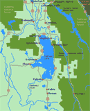
Click on Flathead Valley Area Map to locate cities and towns and other features of the Flathead Valley in Northwest Montana.
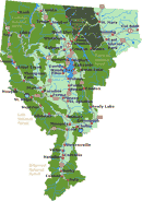
The relief map of Northwest Montana will help you locate geographical features such as rivers and mountains.
More Northwest Montana
Bitterroot
Valley
Blackfeet Indian Res.
Clark Fork River
Flathead Valley
Kootenai Valley
Missoula Valley
Seeley Swan Valley
Montana Travel Regions and Maps:
Map
North Central
Map
Northeast
Map
Northwest
Map
South Central
Map
Southeast
Map
Southwest
Northwest Montana Travel Region
Hungry Horse, Montana
Hungry Horse, population about 900, is one of those small communities likely to be overlooked on the way to Glacier National Park, which lies just 10 miles to the east. But it's worth a stop, either for a traveler's rest break or a place to spend the night prior to a full day in the park.

Worth checking out are the several roadside stands offering various concoctions made from native huckleberries. The best are the huckleberry milk shakes that leave you wanting more. A worthy side trip is the nearby Hungry Horse Dam (406-387-5241) and the 34-mile-long Hungry Horse Reservoir. A road circling the reservoir provides easy access to many hiking areas in the nearby national forests and wilderness areas.
Go Northwest! travel guide provides you with all the visitor information you need to when planning a trip to Hungry Horse. Just use the navigation links in the left hand column or the drop down menu at the top of the page to find where to stay, where to eat, what to see and what to do.
|
Weather |
Click on the town and road map to locate cities, towns and attractions. |
Go Northwest!
Bookstore
Best selection of books on the Northwest.
Click
here!
 Moon Montana,
9th Edition (Moon Handbooks) by Judy Jewell and W.C. McRae. This guide
has complete information about all of Big Sky Country, from Yellowstone
National Park to the eastern prairies of the state, to help the traveler
plan a memorable vacation.
Order now...
 Montana
Adventure Guide by Genevieve Rowles. Offering coverage of the history,
culture, geography and climate, this book also looks at wilderness trips in
Montana, USA. Areas featured include Flathead and Clearwater Mountains, and
fly-fishing, Nordic skiing, rock-hounding and overnight hiking excursions
are all covered.
Order now...
Montana
Adventure Guide by Genevieve Rowles. Offering coverage of the history,
culture, geography and climate, this book also looks at wilderness trips in
Montana, USA. Areas featured include Flathead and Clearwater Mountains, and
fly-fishing, Nordic skiing, rock-hounding and overnight hiking excursions
are all covered.
Order now...
 Benchmark
Montana Road & Recreation Atlas by Benchmark Maps. Large-scale Landscape
MapsTM and a complete 30-page Recreation Guide make it the ideal planning
tool for any outdoor adventure. Benchmark field-checkers drove thousands of
miles to make sure the Montana Road & Recreation Atlas is the most accurate
and reliable map product.
Order now...
We appreciate your orders. They help keep
Go Northwest! online.
Northwest Books
from . . .
![]()


